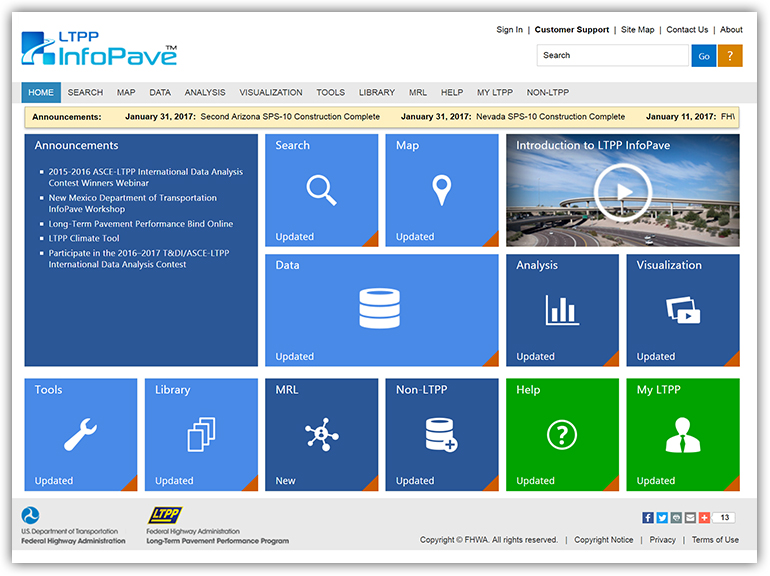
iENGINEERING is proud to have designed and developed the LTPP InfoPave, a web-based interface that facilitates access and analysis of Federal Highway Administration’s (FHWA) Long-Term Pavement Performance (LTPP) data through a variety of online data selection and visualization tools. We developed this solution to allow organized and secure storage of an enormous amount of LTPP data on the cloud infrastructure.
LTPP InfoPave includes creative tools for data viewing, identification, and selection that help users create their own personalized data sets, summary reports, queries, and much more. It gives users the ability to share data selections, views, or queries with other users, which can exponentially improve LTPP data usage across geographic boundaries and time zones. With LTPP InfoPave, LTPP data are at people’s fingertips, allowing them to obtain the right data efficiently and extract practical information regarding pavement engineering and management. All this was only made possible by the efforts and hard work of the iENGINEERING team. iENGINEERING also provides support and enhancement services for the project.
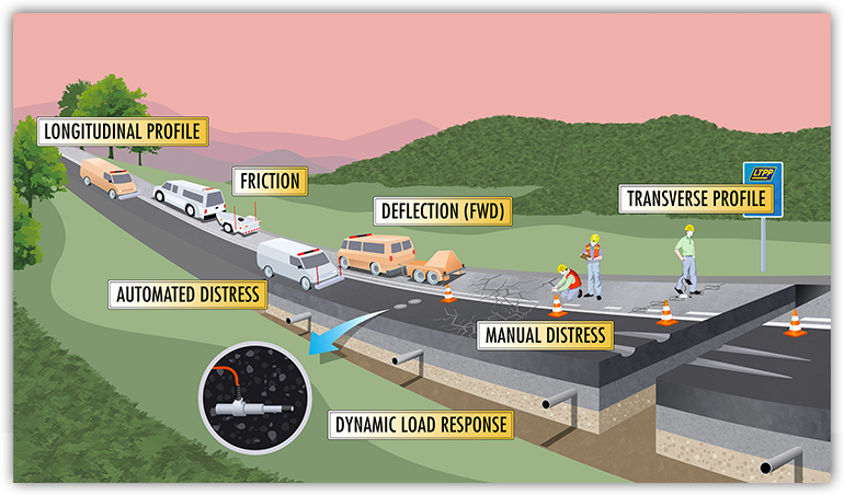
The Federal Highway Administration’s (FHWA) Long-Term Pavement Performance (LTPP) program is the world’s largest pavement performance monitoring study, collecting data on performance, traffic, and climate at 2,514 in-service highway test sections throughout the United States and Canada. This data consists of information about potholes, road conditions, weather impact, and other ways to prolong the service life of highway infrastructure.

All of the data collected at the thousands of sites is stored in an electronic warehouse called InfoPave. To make use of all of this data, the FHWA’s goal was to build a user-centric portal for users to access and download the data to conduct their own research. Over 2,500 federal, state, academia, and international users now have access to the data at a minimal cost to FHWA. The FHWA turned to a powerful and flexible tool – the cloud. In their path to the cloud, the FHWA looked at available technologies, storage, and support. Eventually, they went from a co-location environment to a hybrid model, using Amazon Web Servers, based on the cost and readiness of the platform. Over the next few years, they saw many enhancements and better tools as the volume of data increased and the architecture evolved.
The LTPP InfoPave portal has seen over 10,000 downloads and 400-500 gigabytes of data downloaded in one year. The user experience is easy with a data bucket, similar to a shopping cart, so users can look at the data and add it to their bucket. LTPP InfoPave also provides powerful interactive features that enable visualization of LTPP data, demonstrating the timeline of pavement construction and rehabilitation activities, showing changes in the pavement structure with time, plotting pavement performance metrics with time, demonstrating the correlation among various data elements, and providing the collected pavement images and videos.

Over 650 projects have already been conducted around the world analyzing the collected data to further the research on the pavement. For example, the data was used to design pavement by the American Association of State Highway and Transportation Officials (AASHTO) to maintain standards so engineers can make informed, cost-effective decisions on treatment types. The modeling wouldn’t have been possible without the available data. This saved the nation millions of dollars through treatments for improving the life of the pavement, and solving a real-world problem in real time.
The next step for FHWA was to process NASA’s climate data and make it available for the research community through InfoPave. Thirty years of hourly climatic data—temperature, wind speeds, and solar radiation—collected by NASA is significant for the pavement industry. In this regard, thirty TB of climate data went live in July 2016, which adds a lot of extra load to the storage platform. But due to the flexible and scalable AWS cloud infrastructure design implemented by iENGINEERING, the FHWA was able to add the required storage capacity and share the climatic data with their users.
With our design exploiting the flexibility of the cloud architecture, the data has been made public in a secure and cost-effective way. The project has been extremely successful and has received a great deal of appreciation from all those concerned with the transportation industry.


